Monday, September 14, 2015
Hike 31: Fraser Preserve
I tried to do this one the same afternoon as Scotts Run, but the parking situation here is REALLY ODD, so I gave up. Basically, the gate into the camp area is locked so you have to park on a single-lane road that doesn't really have room for you to park on, go through the locked gate (sketchy, if you ask me), and then hike a mile to the trailhead on a gravel driveway. I bailed after I tried to park and nearly fell in a ditch.

Hike 27: Mount Vernon Trail and Fort Hunt Park
Totally did not know you could hike to Mount Vernon! From Fort Hunt Park, it's not too bad!
 This is a pretty straightforward multi-use trail.

We spent some time at Mt. Vernon as well, although it was rainy and sticky humid and Mt. Vernon was under construction so we didn't linger.


We spent some time at Mt. Vernon as well, although it was rainy and sticky humid and Mt. Vernon was under construction so we didn't linger.

Hike 30: Scotts Run Nature Preserve
This area is tucked into a little corner of Falls Church next to the Potomac.
 There are signs everywhere telling people not to swim, but that's pretty much completely ignored. Most of the people on the trail with me were wearing bathing suits and the waterfall that spills into a little pool before flowing into the Potomac is filled with teenagers splashing around.

It's actually a little obnoxious because there are a lot of remnants of drunken parties lying around what should be a beautiful area. The trail itself is also poorly maintained on the eastern half of the preserve so you have to scrabble through a lot of brush. But it makes things a little adventurous, I suppose. And a little spooky... :)


It's actually a little obnoxious because there are a lot of remnants of drunken parties lying around what should be a beautiful area. The trail itself is also poorly maintained on the eastern half of the preserve so you have to scrabble through a lot of brush. But it makes things a little adventurous, I suppose. And a little spooky... :)

Hike 25: Holmes Run Parklands
I did this hike while Chris was out of town and ventured into Virginia all by myself! :) This was in a area near Alexandria. You start near Duke Street in a parking area behind a library. You cross a bridge onto the walking trail to Holmes Run Greenway.

 The directions in the book are actually really confusing so I didn't follow them. I just followed the trail all the way to downtown Alexandria. It's quite scenic, but there isn't a lot of shade once you get to the part of the trail that parallels the driving road.


Sunday, July 19, 2015
Hike 38: Magruder Branch Trail
Chris and I did this for our anniversary celebration!
 It starts really close to our home, at a rec park with a huge soccer field and baseball diamond too. You have to walk from the parking lot to a paved loop trail that lots of people use for running before you get to the turnoff to the dirt hiking trail. It's pretty straightforward with some areas that are a bit overgrown (I made Chris go first in those sections). Eventually you pass this open field area behind a bunch of giant mansions and then you run into Seneca Creek.
 It looks like you should be able to continue across the creek to the Seneca Greenway Trail, which we've done from the other end. It was a nice spot to munch on our PBJ sandwiches.
 On our way back, Chris picked a nice ripe blackberry - it was actually really sweet! He really wanted to see a black bear, but no such luck. :)


Hike 24: Watkins Regional Park
This place is fantastic for kids! There's a great nature center that you start at and lots of little trails.
 The longest one is called "Spicebush Trail" and it takes you the whole way around the park. It's a little overgrown and I don't think many people walk the trail. I was periodically freaked out by spiderwebs strung across the trail, but it wasn't awful. The book says the trails are "mostly names, signposted, and color coded" and that's true for the most part but sometimes the trails end very abruptly in a field of nothing.

And Spicebush Trail sort of dead ends into a parking lot and I never found the rest of the trail, so I wandered around and eventually followed a road back to the nature center. But that's when I discovered the best part! They have an old farm that wasn't open that day, but you can wander around outside the fence and they have PEACOCKS! I took pictures and videotapes for a good twenty minutes. They were so cool. They also have turkeys and chickens and probably some mammals too, but I couldn't see them.


And Spicebush Trail sort of dead ends into a parking lot and I never found the rest of the trail, so I wandered around and eventually followed a road back to the nature center. But that's when I discovered the best part! They have an old farm that wasn't open that day, but you can wander around outside the fence and they have PEACOCKS! I took pictures and videotapes for a good twenty minutes. They were so cool. They also have turkeys and chickens and probably some mammals too, but I couldn't see them.

Sunday, June 28, 2015
Hike 13: Capital Crescent Trail
I was originally planning to bike this trail, but when a friend asked if I wanted to go on a hike with her, I had a brilliant idea to hike from Bethesda to Georgetown, have lunch down there, wander around and shop, and generally make a day of it! Of course the day we planned was one of the hottest days of the year - mid 90s and humid. I woke up kind of icky, but I figured I was just hungry so I had some breakfast and we met up with Caitlin. A few texts back and forth to figure out where on the trail we were meeting, but we got started with no problems. Lots of chit chat about work and such and we made it to the Daelcarlia Tunnel, "built in 1910 to carry the railroad line under both Conduit Road (now MacArthur Blvd) and the pipes carrying river water to Dalecarlia Reservoir."

I was starting to slow down a bit, but I figured it was just hot, so I kept drinking my water, but it wasn't helping. We made it to a refurbished ex-railroad bridge right after leaving Montgomery County, and I had to take a break and sit on an electric box or something. Caitlin did some research on where we were and Chris went down to Fletcher's boathouse to check out the facilities there. Caitlin went up a small trail to see if it led back to a main road where we could hop off and go home. I thought I was doing better until I threw up behind the electrical box. :( After that, I figured it wouldn't be a good idea to soldier on, so when Chris came back from the boathouse, we went up the little trail back onto Arizona Ave. Caitlin and I got drinks at a Starbucks and she started calling cab companies. Chris, who was feeling totally fine, ran up Wisconsin Ave to meet us at Tenleytown Metro. Of course, he beat us there! That was pretty much the end of that hike. It was sort of pathetic...


I was starting to slow down a bit, but I figured it was just hot, so I kept drinking my water, but it wasn't helping. We made it to a refurbished ex-railroad bridge right after leaving Montgomery County, and I had to take a break and sit on an electric box or something. Caitlin did some research on where we were and Chris went down to Fletcher's boathouse to check out the facilities there. Caitlin went up a small trail to see if it led back to a main road where we could hop off and go home. I thought I was doing better until I threw up behind the electrical box. :( After that, I figured it wouldn't be a good idea to soldier on, so when Chris came back from the boathouse, we went up the little trail back onto Arizona Ave. Caitlin and I got drinks at a Starbucks and she started calling cab companies. Chris, who was feeling totally fine, ran up Wisconsin Ave to meet us at Tenleytown Metro. Of course, he beat us there! That was pretty much the end of that hike. It was sort of pathetic...

Hike 8: Military Sights in Upper Northwest Washington
This hike started at the Nature Center in Rock Creek Park. I stopped in to grab a map of the park and it's a good thing, because the trails aren't particularly well marked and I sort of turned the wrong way after seeing Fort DeRussy. Which isn't much of a fort, actually - now it's just a plaque saying that a fort used to be there.
 I had intended to do a loop up Oregon Ave to the north side of the park and then come back down on the Beach Dr side, but I ended up do a little zigzag. I was tooling along at a nice little pace with trail runners passing me in both directions when it started to thunder in the distance. The weather forecast said the rain was supposed to start around rush hour, and it was only about 2PM, so I figured it was far enough away that I would be fine. Or not...
 Honestly, after a while, you don't even notice being wet. Luckily I had a hat on, otherwise my glasses would have been completely covered and I would have been blind. I walked through torrential rain for about 30 minutes before it tapered off. It actually stopped raining for a while, but I still had a few miles to go. I didn't really stop to sight see, but the extra water from the rain made Rock Creek quite picturesque.
 About ten minutes from the parking lot, the thunder started rumbling again, and not a minute after I made it back to the car, PHOOM!, the sky opened up even more than before! It was way darker at this point too. It made driving out of the park pretty interesting with all the road flooding. One of the more exciting hikes I've done, that's for sure!


Sunday, June 7, 2015
Hike 7: Brookland
After a few years doing other things, we're back! I am on a Kilimanjaro training mission, and will be spending a few days a week hiking again. I meant to do more in the spring, but it's tough finding the time! This hike was a special treat for me - I played hooky from school on a beautiful spring morning and met up with an old friend from college afterwards.
The first stop, conveniently located by a parking lot, was the Basilica of the National Shrine of the Immaculate Conception. It's a long name, but a beautiful building! Apparently, it's the world's eighth largest church. Who knew? Right in the middle of DC!

I spent some time wandering around inside (it's a bit intimidating, but everyone is very welcoming), and then, of course, got lost headed in the wrong direction from the map. Interestingly, I found Trinity University, which several of our students attend.

Eventually, I wound my way back around and headed up to Rock Creek Cemetery, passing a couple interesting sites along the way, including the Saint John Paul II Memorial Shrine and the Washington Retreat House.

According to the book, this is the city's oldest burial ground (1719). I didn't actually enter the cemetery, but it had some very interesting gravestones and monuments that you could see from the surrounding fence. After the Rock Creek Cemetery, you can also see the U.S. Soldiers' Home National Cemetery, which dates from 1861 as a burial ground for Civil War soldiers.
Last stop on the "official" hike was Brookland Metro, which I took into Union Station to meet up with my friend. I actually got there a little early, so I made a quick stop into the U.S. Postal Museum, which I'd never been to before. I learned all about Owney, the postal mascot!

The first stop, conveniently located by a parking lot, was the Basilica of the National Shrine of the Immaculate Conception. It's a long name, but a beautiful building! Apparently, it's the world's eighth largest church. Who knew? Right in the middle of DC!

I spent some time wandering around inside (it's a bit intimidating, but everyone is very welcoming), and then, of course, got lost headed in the wrong direction from the map. Interestingly, I found Trinity University, which several of our students attend.

Eventually, I wound my way back around and headed up to Rock Creek Cemetery, passing a couple interesting sites along the way, including the Saint John Paul II Memorial Shrine and the Washington Retreat House.

According to the book, this is the city's oldest burial ground (1719). I didn't actually enter the cemetery, but it had some very interesting gravestones and monuments that you could see from the surrounding fence. After the Rock Creek Cemetery, you can also see the U.S. Soldiers' Home National Cemetery, which dates from 1861 as a burial ground for Civil War soldiers.
Last stop on the "official" hike was Brookland Metro, which I took into Union Station to meet up with my friend. I actually got there a little early, so I made a quick stop into the U.S. Postal Museum, which I'd never been to before. I learned all about Owney, the postal mascot!

Sunday, August 5, 2012
Hike 23: Seneca Ridge Trail
This one definitely goes in my top ten, maybe even top five! The book calls this the Greenway Trail, but I have no idea why...all the signs say Seneca Ridge. Anyway, it's a really fun hike with interesting terrain, changes in scenery, and it's not scary, which, given my last few hikes, was a definite plus!
You start at Black Rock Mill, which is just an abandoned building now, and, according to the book, was the site for some scenes in The Blair Witch Project...it doesn't look spooky in the daylight. :)

This hike is popular with bikers too, although I can't imagine doing it without killing myself. There are some serious ups and down and bumpy sections for anyone on wheels.

I turned around at the first road crossing (Germantown Road), but you could keep going for another 4 miles. There will definitely be a next time on this hike!

You start at Black Rock Mill, which is just an abandoned building now, and, according to the book, was the site for some scenes in The Blair Witch Project...it doesn't look spooky in the daylight. :)

This hike is popular with bikers too, although I can't imagine doing it without killing myself. There are some serious ups and down and bumpy sections for anyone on wheels.

I turned around at the first road crossing (Germantown Road), but you could keep going for another 4 miles. There will definitely be a next time on this hike!

Sunday, July 29, 2012
Hike 22: Henson Creek Trail
After wigging out at Cosca Regional Park, I drove a couple miles down the road to the next hike, a trail through Henson Creek Park. It had great potential and looked very hiker friendly, but there was one little problem...

This happened about a half a mile down the trail, so I turned around and went back. Ah well...not the best hiking day I've had. Oh - I did discover Andrews Air Force Base on the way home! :)

This happened about a half a mile down the trail, so I turned around and went back. Ah well...not the best hiking day I've had. Oh - I did discover Andrews Air Force Base on the way home! :)
Saturday, July 28, 2012
Hike 21: Cosca Regional Park
Completely wigged out on this hike! It started out fairly auspiciously, except for the fact that this is about as far away from Germantown as you can be while still in the DC Metro Area. Cosca Regional Park boasts a large nature center which has lovely landscaping and lots of kids going in and out for summer programs while I was in the parking lot.

I followed the trailhead around the back of the nature center and stumbled upon a little mini-bird zoo. They had four large birds of prey (2 red tailed hawks, great horned owl, bald eagle) on display and that was the best part of the whole hike.

It was a super humid day (sweat was dripping off me as I was standing still) and the trail was pretty messy. I was a little annoyed by the number of spider web strings that kept getting stuck to me but I talked myself through that...until I walked into a web and the spider landed on me! I am not brave with bugs. I shrieked a little and flicked him off. As I'm psyching myself up to keep going, I walk smack into a spider and its web with my face. ACK! That was it. I turned around and went back to the car.

I followed the trailhead around the back of the nature center and stumbled upon a little mini-bird zoo. They had four large birds of prey (2 red tailed hawks, great horned owl, bald eagle) on display and that was the best part of the whole hike.

It was a super humid day (sweat was dripping off me as I was standing still) and the trail was pretty messy. I was a little annoyed by the number of spider web strings that kept getting stuck to me but I talked myself through that...until I walked into a web and the spider landed on me! I am not brave with bugs. I shrieked a little and flicked him off. As I'm psyching myself up to keep going, I walk smack into a spider and its web with my face. ACK! That was it. I turned around and went back to the car.
Thursday, July 26, 2012
Hike 20: Patuxent Research Refuge
Hiked this with Biz a couple weeks ago. She'd actually been before cuz some of her students did internships here, studying wetlands birds and whatnot. It's near Laurel and farther north in PG County than I'd realized. The refuge used to be where Fort Meade was and when you enter, you have to go to the ranger station and register your car and sign a form that says you won't take stuff even though the whole area's been cleared out of anything smacking of potentially confidential military paraphernalia.

There are a bunch of intersecting loop trails, totally about 15 miles. We did about 5 of them and saw an interesting collage of nature. The trail started out with a nicely wooded trail and then opened up onto basically a dirt road that led to a little pond.

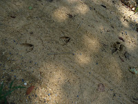
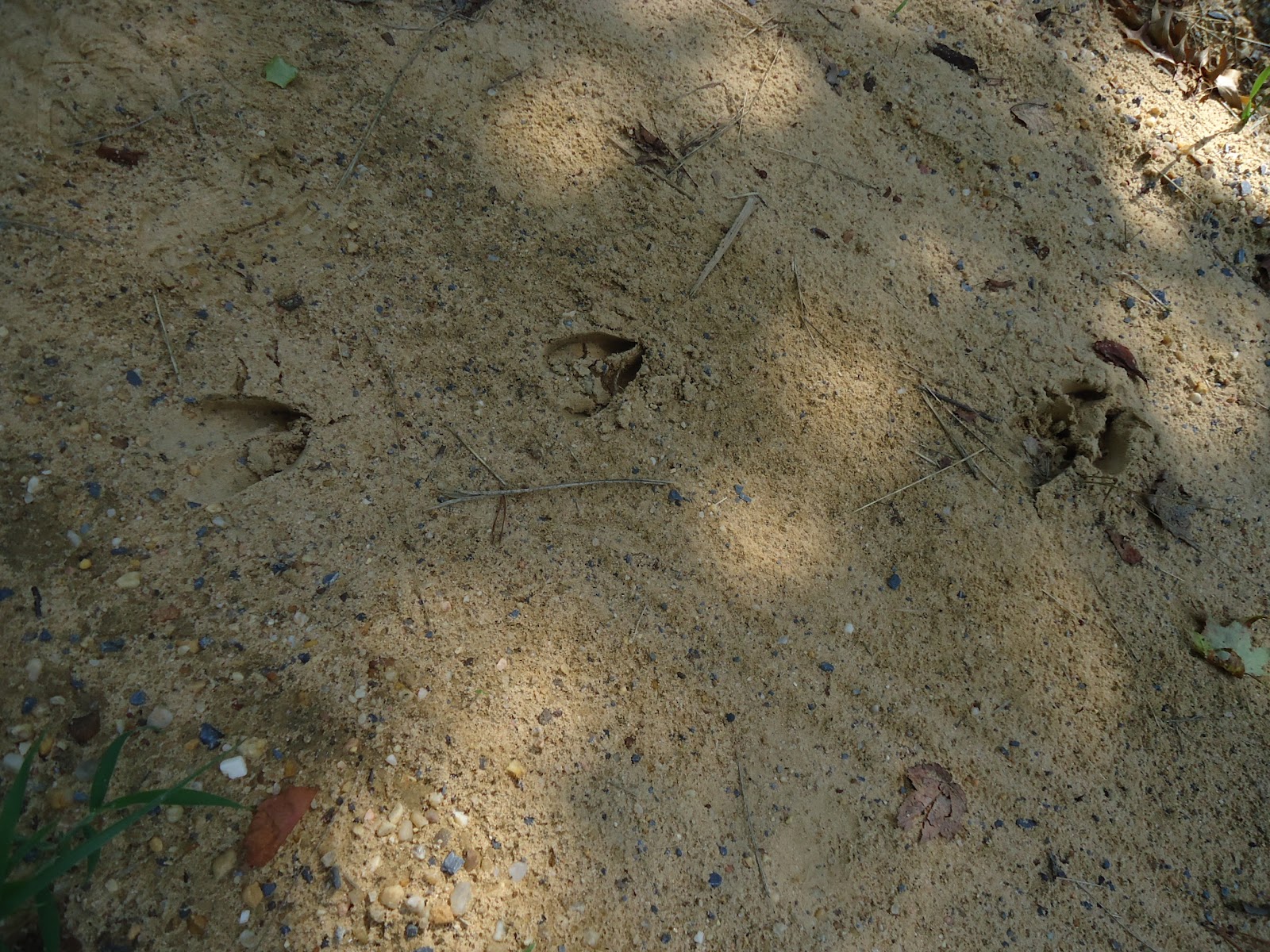
It was very serene and Biz identified woodpeckers and cicadas. My woodsense is about as good as my directional sense. :) She spotted all sorts of wildlife - goldfinches, some green beetle thing, dragonflies, butterflies, and even found deer tracks!
After a little more hiking down the dirt trail, the path opens up and you see these gigantic power line towers. There wasn't a whole lot of shade on this part of the trail so we booked it back around to the woodsy part.

It's a nice little place, but there's long sections of unattractive road so not my favorite hike so far.

There are a bunch of intersecting loop trails, totally about 15 miles. We did about 5 of them and saw an interesting collage of nature. The trail started out with a nicely wooded trail and then opened up onto basically a dirt road that led to a little pond.

It was very serene and Biz identified woodpeckers and cicadas. My woodsense is about as good as my directional sense. :) She spotted all sorts of wildlife - goldfinches, some green beetle thing, dragonflies, butterflies, and even found deer tracks!
After a little more hiking down the dirt trail, the path opens up and you see these gigantic power line towers. There wasn't a whole lot of shade on this part of the trail so we booked it back around to the woodsy part.

It's a nice little place, but there's long sections of unattractive road so not my favorite hike so far.
Tuesday, July 24, 2012
Hike 19: Greenbelt Park
Greenbelt Park is a nice little camping area in PG County with about 8 miles of hiking loops. It's a nicely wooded trail with a few joggers (hard to do on such uneven ground!) and lots of dog walkers.

It's very easy to get to and the trail is easy to follow. I say this with the caveat that I did get a little bit lost even with a map, but that's just cuz I'm directionally deficient. :) All I did was end up on a dead end trail and had to turn back to the loop part. There was a LOT of derecho damage to look at. Trees were just ripped in half and there was all sorts of debris lying on the ground.

It was super humid the day I hiked, so I shortened the loop quite a bit. The only real downside to this hike is that it's pretty far away from my house. It's just as easy for me to get the same feel hiking around the Germantown lake.

It's very easy to get to and the trail is easy to follow. I say this with the caveat that I did get a little bit lost even with a map, but that's just cuz I'm directionally deficient. :) All I did was end up on a dead end trail and had to turn back to the loop part. There was a LOT of derecho damage to look at. Trees were just ripped in half and there was all sorts of debris lying on the ground.

It was super humid the day I hiked, so I shortened the loop quite a bit. The only real downside to this hike is that it's pretty far away from my house. It's just as easy for me to get the same feel hiking around the Germantown lake.
Wednesday, July 18, 2012
Hike 18: Lake Artemesia

This was a lovely little hike around a lake in Greenbelt. (Not sure what the black smoke is...something was burning...) It's a lot like the hike around the little lake behind our house in Germantown. Totally paved, 2.5 mile loop - lots of joggers, fishers, and bird watchers and cute little places to sit and enjoy nature. The chorus of cicadas was pervasive and the Metro passing by every couple minutes was fun - I can totally see kids loving it!

There are two places you can connect to longer trails - Paint Branch Trail, which goes further north in PG county, and the Northeast Branch, which leads south toward DC, eventually meeting the Northwest Branch, where they merge into the Anacostia. All in all, it was a very nice hike and I'd definitely go again.
Tuesday, July 17, 2012
Hike 17: McKee Beshers Wildlife Management Area
I should have known when I read the description of this hike to stay away...this is the kind of hike where my mom thinks I will get mauled by bears or something. The book first describes the hike as former farmland managed as habitat for game species and other wildlife - cool, right? I like deer and looking at wildlife. How bad can farmland be? Then the warnings start..."Follow my directions carefully because the WMA segments are unblazed and unsignposted." Great. I get lost easily enough as it is! "The WMA is seasonally poular with both vicious insects and hunters." Hm... "Beware of periodic field trials when hunters are allowed to shoot birds for their dogs to retrieve." Double hm...
Well, I'll try it anyway - it's right off River Road, easy to find. I find a parking spot off River Road, but I don't see any trails and the path is blocked off by a yellow gate. Not sure if I'm just supposed to just walk around it, so I keep driving onto an inner road along the trail. This road is completely unpaved and very bumpy in a car...no big deal, if I'm walking it won't be bumpy. Then it starts to get sketchy. First of all, there is NO ONE around. Second, there are signs on every other tree that say "Beware of active hunters." Third, there's no path and the area right off the road is completely overgrown and flooded. And this was the clincher...bugs were hitting my car as I drove past, but I wasn't real worried cuz I had bug spray and they might have been dragonflies, which are harmless. Nope, not dragonflies. GIGANTIC BEES. And that was the fat lady singing on this hike! Can you imagine? I'd have been lying in the middle of the road, shot by a hunter or dying from hundreds of bee stings. Sheesh.
Well, I'll try it anyway - it's right off River Road, easy to find. I find a parking spot off River Road, but I don't see any trails and the path is blocked off by a yellow gate. Not sure if I'm just supposed to just walk around it, so I keep driving onto an inner road along the trail. This road is completely unpaved and very bumpy in a car...no big deal, if I'm walking it won't be bumpy. Then it starts to get sketchy. First of all, there is NO ONE around. Second, there are signs on every other tree that say "Beware of active hunters." Third, there's no path and the area right off the road is completely overgrown and flooded. And this was the clincher...bugs were hitting my car as I drove past, but I wasn't real worried cuz I had bug spray and they might have been dragonflies, which are harmless. Nope, not dragonflies. GIGANTIC BEES. And that was the fat lady singing on this hike! Can you imagine? I'd have been lying in the middle of the road, shot by a hunter or dying from hundreds of bee stings. Sheesh.
Saturday, July 14, 2012
Hike 12: Glover Archbold Park
Well, I tried to do this hike yesterday, but encountered parking issues. The book said to park at Fletcher's Boathouse off Canal Road, but I couldn't get there. It might have been because Canal Road is only one-way into DC during rush hour, but there was no way to turn into the parking lot from the direction I was going. And there's nowhere to park on Canal Rd after you've passed some of the locks further up north. So I ended up on GW Parkway headed north on River Rd to try Hike 17. I might try this hike again, but I might need a DC native to go with me because the directions to get there are really vague: "walk down the Capital Crescent Trail and find a tunnel" or "north of the flowershop, there's a field that leads to the path." Really?
OK, it's almost three years later and I finally found the park! The trick is to go at it from the north, not the south. This time I took the metro to Tenleytown, walked a few block to Van Ness, and the "trailhead" is in that vicinity. It's mostly a dirt path in the middle of a field...not the best-marked thing in the world. But thanks to Google Maps, I only overshot it once! This is actually one of my new favorite hikes. It's sort of weird because you're in the middle of a forest and then you're on one of the busiest streets in DC and you repeat that a couple times. But it's really quite straightforward and lovely. All sorts of people are on the trail walking their dogs, trail running, taking a break from work...

I happened to be on the trail a day after a major thunderstorm that almost knocked a tree branch onto our car and broke our patio umbrella.
 I mention this because this created some very interesting road blocks that appeared intermittently during the hike. One you just sort of crawled through, one you walked around, and the third one you had to climb over.
 But pretty soon, you make it to the Capital Crescent Trail, which somehow connects to the C&O Canal Towpath, and tada!, Georgetown is right there! I've never been to Georgetown, and that seems a travesty after living in the area for almost fifteen years, so what's the first place I visit? Georgetown Cupcake, of course! Plus I was getting hungry. One chocolate hazelnut cupcake and and Izze soda later, I was ready to explore!
 I walked back to the waterfront, where people were playing in a community fountain, lounging around in the grass, and eating a riverside lunch. Everyone in Georgetown looks like they belong in a really high tax bracket. :) I wandered down M Street and found the Old Stone House, which is a historic building from the 1700s.
 After that, I decided I'd walk back up Wisconsin as far as I could before hitching a ride on a bus to go back to the Metro station. Deciding where to eat lunch was rather difficult - I wasn't exactly dressed for a sit down place, and eating at Subway in Georgetown seemed like a waste. I found a really cute deli and had a smoothie and tuna sandwich. And then I found a place that made homemade ice cream and chocolate! Of course, I made myself sick eating all this stuff. Sigh. Trudged slowly to Tudor Place and wandered around the gardens there.
 Thought about going to Dumbarton, but that one cost $10, so I'll wait until I have out-of-towners to visit there. At this point I was getting pretty tired of the sun (I forgot my hat), so I hopped on a bus and made it back none the worse for wear!
OK, it's almost three years later and I finally found the park! The trick is to go at it from the north, not the south. This time I took the metro to Tenleytown, walked a few block to Van Ness, and the "trailhead" is in that vicinity. It's mostly a dirt path in the middle of a field...not the best-marked thing in the world. But thanks to Google Maps, I only overshot it once! This is actually one of my new favorite hikes. It's sort of weird because you're in the middle of a forest and then you're on one of the busiest streets in DC and you repeat that a couple times. But it's really quite straightforward and lovely. All sorts of people are on the trail walking their dogs, trail running, taking a break from work...

I happened to be on the trail a day after a major thunderstorm that almost knocked a tree branch onto our car and broke our patio umbrella.


Hike 16: C&O Canal
Bike/hiked this trail last year with the Boettchers - so cute! Next time, Schuyler will be all by herself and Townsend will be in the buggy!

Not sure where we started, but we ended up at Riley's Lock where they had Girl Scouts dressed up in period costume running tours of Riley's Lockhouse.

The C&O Canal is a great biking trip. It's flat and the path is wide and you can't get lost. :) It's a little slow to hike, I think, and the scenery is pretty monotonous.


Not sure where we started, but we ended up at Riley's Lock where they had Girl Scouts dressed up in period costume running tours of Riley's Lockhouse.

The C&O Canal is a great biking trip. It's flat and the path is wide and you can't get lost. :) It's a little slow to hike, I think, and the scenery is pretty monotonous.
Monday, July 9, 2012
Hike 15: Billy Goat Trail and Great Falls
I've been in Colorado the last week, so I haven't been on any new hikes, but Billy Goat Trail is definitely one of my favorites! The Billy Goat Trail is connected to the C&O Canal Towpath, but the easy gravel pathway along the towpath is not at all indicative of the rocky climbs along the Billy Goat Trail.

The BGT has three sections (A, B, and C) and A is the hardest, but it's also the most fun and has awesome views of the Potomac River.

You can't bring dogs onto Section A, though, so the first time I hiked it, we only did Section B and C.
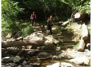
As you can see from the next picture, Section A is a bit more challenging...

...but never boring!

The BGT has three sections (A, B, and C) and A is the hardest, but it's also the most fun and has awesome views of the Potomac River.

You can't bring dogs onto Section A, though, so the first time I hiked it, we only did Section B and C.

As you can see from the next picture, Section A is a bit more challenging...

...but never boring!
Subscribe to:
Posts (Atom)